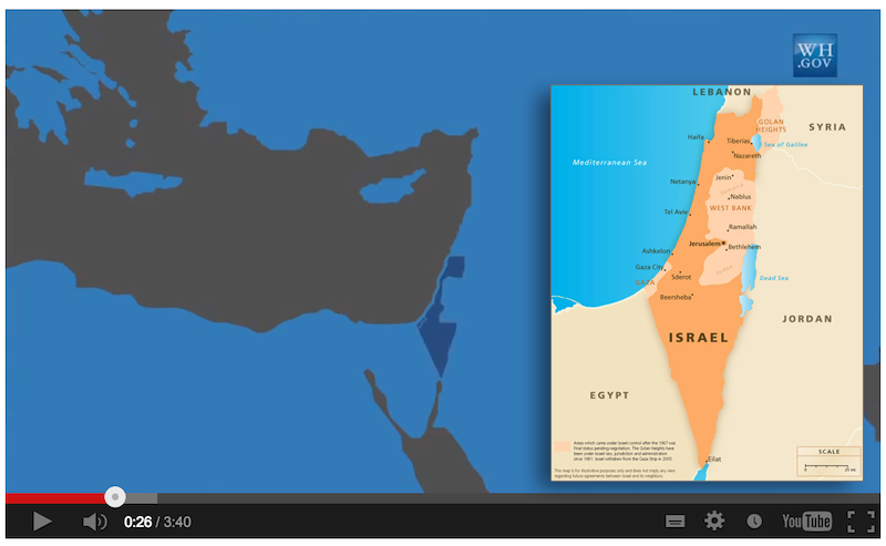
The map of Israel, displayed repeatedly during the video, shows the Golan Heights, Jerusalem, northern Israel, and areas surrounding what is currently the West Bank as non-Israeli territory. The Golan Heights is shown as part of Syria; Jerusalem is shown as part of the West Bank; and northern Israel is shown as part of Lebanon.
To view the video and hear the official White House spokesman, visit
http://freebeacon.com/obamas-middle-east-map-erases-israeli-territory/
The Washington Free Beacon
March 18, 2013
No comments:
Post a Comment